Time to get out the hiking boots - in The Aarhus Region there are many great hiking possibilities. Explore forests, river valleys, lakes, rivers, beaches and even mountain hikes in National Park Mols Bjerge, the Lake District around Denmark's Outdoor Capital, Gudenåen, Hærvejen etc.
Photo: Magnus Torfoss
Photo: Nicole Wolter
The path Mols Bjerge-stien
Take a wonderful hike along the certified Mols Bjerge Trail, which stretches for an impressive 80 kilometres. You can divide it into 4 day stages of approximately 20 km each.
The Silk Route Silkeruten is a 12 km path encircling the central part of Silkeborg, along which you will see lovely scenery and cultural experiences. Walking along Silkeruten gives you a broad glimpse of what the Silkeborg woodlands have to offer.
If you love hiking, a hike through the Lake District Søhøjlandet around Silkeborg, the Outdoor Capital of Denmark and Aarhus is an absolute delight. Enjoy the forests, river valleys and many lakes that the Danish Lake District is known for.
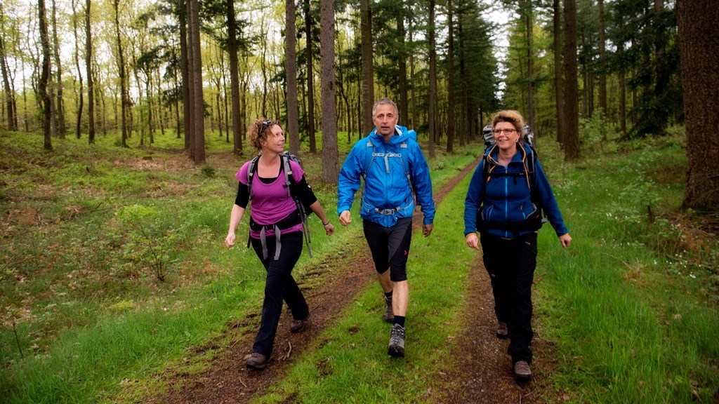
The Forest Route at Mollerup Skov has two different starting points, one by the parking ground in Mollerup Skov by Skejbyvej (A) and one by the dog training facilities of DCH on Viengevej (B).
Walk in the footsteps of the past in Mols Bjerge National Park and enjoy a refreshing hike through Trehøjestien and the certified hiking trail Toggerbo. The 4.1 km hike is a true gem for those who love beautiful nature combined with an exciting history.
This hiking trail, also known as the Mountain Trail, begins at the foot of the northern ‘mountain’, Jernaldervej. The eight-kilometre-long route is ideal for running and hiking, but large parts of the route can also be covered by bicycle.
This walking and running route is also called the Pulse Route and starts in Riis Forest at the car park between the old forester's building and the hostel. The route follows the running route around the forest.
At the foot of Mols Bjerge National Park, Kalø Slotsruin is located on a bank in the cove, Kalø Vig. If you follow the old stone-paved path out onto the peninsula, it’s like travelling back 700 years.
Trehøje are three majestic hilltops that proudly rise 127 metres above sea level in the middle of the scenic Mols Bjerge National Park. Discover the height of natural beauty as you climb these peaks and marvel at the impressive landscape.
If you enjoy a walk in the forest, you do not want to miss the Kaloe forests. At Kalø castle ruin you will find both Hestehave forest and Ringelmose forest.
The Gudenå Trail brings together hiking experiences along Denmark’s longest river, the Gudenå, into a single continuous route. In the Aarhus region, you can explore the trail through towns such as Silkeborg, Favrskov and Randers, enjoying nature, cultural heritage and sections close to the water.
The railway path between Viborg and Herning is also known as Alhedestien (cycle route no. 21) and is built on the disused Herning-Viborg railway line. The continuous trail system between Viborg and Herning is approximately 49 kilometres long and is great for hiking, cycling and horseback riding.
Hiking along the Historic Trail Hærvejen by Viborg
Hærvejen is (perhaps) Denmark’s most well-known hiking trail. Stretching hundreds of kilometres through central Jutland, the popular trail contains numerous hiking and cycling routes suitable for short and longer distances.
Riding your bike along the railway trail between Viborg and Hammershøj will bring you spectacular views of Nørreådalen valley and Viborg, home to the magnificent cathedral dating back to 1140. The railway was closed down in 1965.
The Nature Trail from Silkeborg to Horsens - 60 km
The closed down railway trail stretching 61 km between Silkeborg and Horsens today takes cyclists, hikers, and horseback riders through luxuriant river valleys, old beech forests, and the hilly Lake District Søhøjlandet in central Jutland.
Start your journey in Ryomgård in Djursland and hike along the 28 km stretch of scenic trail to Gjerrild. The trail runs where the old railway tracks used to go up until 1956.
Take a hike and experience the Kalk Kaminoen near Viborg - a beautiful 30 km long hiking route that winds through forests and open spaces close to the historic Hærvej. This unique hiking route offers a unique opportunity to explore Denmark's beautiful landscapes and exciting attractions.
The hiking trail around Almindsø is 4 kilometres long and is one of the few trails in Denmark that is certified as a Family Trail by the Danish Hiking Association. Here you are guaranteed a beautiful walk in a varied forest area with views of the lake most of the way round.
Take Bjergetapen at the Mols Bjerge trail in Djursland and experience an idyllic landscape you'll never forget. The Bjergetape will make you sweat, but the hike is definitely worth it!
The Bruunshaab trail in Viborg leads you through a fine mixed forest and out over the open areas by the golf course, ensuring you enjoy fantastic scenery.
Are you also interested in old limestone mines? Then this tour from Kongenshus to Stoholm in Viborg is just the thing for you! On this tour you will pass old and exciting limestone mines.
Take the family on a trip and follow the "Gåsehage Etapen" in idyllic Ebeltoft in Djursland. You are guaranteed a fantastic route with city, water, forest and lots of other beautiful nature.
Bring the whole family to Mols Bjerge in Djursland and embark on the easy hiking route Helligkildestien, where you will encounter idyllic scenery and, not least, exciting animals.
Take the whole family on a peaceful and idyllic walk along the trail on Inderøen in Dollerup Bakker in Viborg. Here you are guaranteed plenty of forest and, not least, plenty of views of Hald Lake.
Discover many of the different habitats of Mols Bjerge on the Langemosestien trail in Djursland and pass Langemosen, which has given its name to this fantastic trail.
Enjoy the fresh air and discover large parts of Viborg when you follow Viborg City Trail. Walk alone or bring the whole family on this fantastic route.
Whether you're in the bustling streets of the city or in the quiet surroundings of nature, great hiking conditions await you. Some trails are clearly marked, while others require a bit of exploration. With the right shoes and clothing, you're all set for a great hike - so get out there and let your trainers lead you on new adventures.